


Bernalillo County Precinct 31, Bernalillo County, New Mexico
About
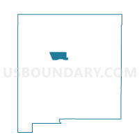
Outline

Summary
| Unique Area Identifier | 623062 |
| Name | Bernalillo County Precinct 31 |
| County | Bernalillo County |
| State | New Mexico |
| Area (square miles) | 202.56 |
| Land Area (square miles) | 201.87 |
| Water Area (square miles) | 0.69 |
| % of Land Area | 99.66 |
| % of Water Area | 0.34 |
| Latitude of the Internal Point | 35.10228240 |
| Longtitude of the Internal Point | -107.04056540 |
Maps


Graphs
Select a template below for downloading or customizing gragh for Bernalillo County Precinct 31, Bernalillo County, New Mexico


Neighbors
Neighoring Voting District (by Name) Neighboring Voting District on the Map
- Bernalillo County Precinct 57, Bernalillo County, NM
- Bernalillo County Precinct 88, Bernalillo County, NM
- Bernalillo County Precinct 93, Bernalillo County, NM
- Cibola County Precinct 2, Cibola County, NM
- Cibola County Precinct 21, Cibola County, NM
- Cibola County Precinct 22, Cibola County, NM
- Sandoval County Precinct 27, Sandoval County, NM
- Sandoval County Precinct 30, Sandoval County, NM
- Valencia County Precinct 1, Valencia County, NM
Top 10 Neighboring County Subdivision (by Population) Neighboring County Subdivision on the Map
- Los Lunas CCD, Valencia County, NM (55,761)
- Belen CCD, Valencia County, NM (20,808)
- West Bernalillo CCD, Bernalillo County, NM (7,796)
- Cuba CCD, Sandoval County, NM (4,986)
- Laguna CCD, Cibola County, NM (4,459)
- Isleta Pueblo CCD, Bernalillo County, NM (2,489)
Top 10 Neighboring Unified School District (by Population) Neighboring Unified School District on the Map
- Albuquerque Public Schools, NM (667,445)
- Los Lunas Public Schools, NM (48,173)
- Grants-Cibola County Schools, NM (27,088)
- Cuba Independent Schools, NM (4,584)
Top 10 Neighboring State Legislative District Lower Chamber (by Population) Neighboring State Legislative District Lower Chamber on the Map
- State House District 29, NM (59,097)
- State House District 60, NM (41,212)
- State House District 12, NM (38,723)
- State House District 8, NM (28,864)
- State House District 10, NM (27,279)
- State House District 69, NM (26,984)
- State House District 65, NM (26,930)
Top 10 Neighboring State Legislative District Upper Chamber (by Population) Neighboring State Legislative District Upper Chamber on the Map
- State Senate District 23, NM (84,821)
- State Senate District 11, NM (77,027)
- State Senate District 22, NM (60,988)
- State Senate District 29, NM (50,755)
- State Senate District 30, NM (48,188)
- State Senate District 14, NM (42,652)
Top 10 Neighboring 111th Congressional District (by Population) Neighboring 111th Congressional District on the Map
- Congressional District 1, NM (701,939)
- Congressional District 3, NM (693,284)
- Congressional District 2, NM (663,956)
Top 10 Neighboring Census Tract (by Population) Neighboring Census Tract on the Map
- Census Tract 9406, Bernalillo County, NM (9,385)
- Census Tract 9747, Cibola County, NM (6,660)
- Census Tract 9461, Cibola County, NM (4,093)
- Census Tract 9714, Valencia County, NM (3,298)
- Census Tract 9407, Bernalillo County, NM (2,489)
- Census Tract 109, Sandoval County, NM (2,318)
- Census Tract 9713, Valencia County, NM (2,077)